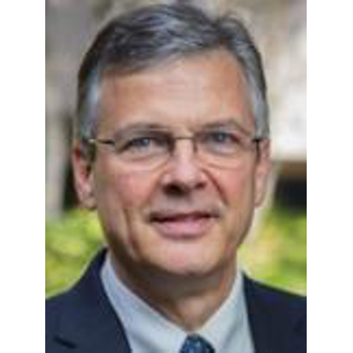
Mr. Christopher B. Curtis, PLS
Sacramento, CA 95825
Office: 916-921-9033
Mr. Curtis has nearly 40 years of experience in land surveying and geomatics engineering with 20 years served as a litigation consultant and expert witness in civil and criminal matters related to location-based 3D geospatial components and visibility perspectives in regard to wildland fire origin and cause, explosions, highway sight distance, workplace injury, catastrophic injury, wrongful death, boundaries, easements, right of way engineering and site monitoring/change detection.
Specifically, Mr. Curtis is qualified to conduct forensic engineering surveys, perform analyses, and offer opinions regarding evidence obtained by or related to the collection and analysis of geospatial data including aerial and terrestrial photography, video, record information, LiDAR, GPS control surveys, photogrammetry, digital terrain modeling, topographic land mapping, GIS, visibility studies, accident reconstruction, animations, the preparation and evaluation of demonstrative evidence and trial court exhibits.
EDUCATION & LICENSES
Bachelor of Science, Geomatics Engineering, California State University, Fresno, CA
Associate of Arts, Forest Engineering, College of the Redwoods, Eureka, CA
California Professional Land Surveyor No. 7579
- 3D Laser Scanning
- Civil Engineering
- Drones
- Forensic Animation
- Forensic Engineering
- Mapping & Surveying
- Photogrammetry
- Professional Engineering
- Visibility
- Q: Please list your professional accreditations, degrees, licenses, and certificates granted:
- A: Professional Land Surveyor No. 7579, CA
FAA – Part 107 UAS REMOTE PILOT No. 3911620
BS - Geomatics Engineering, California State University, Fresno, CA, 1999
AA - Forest Engineering, College of the Redwoods, Eureka, CA, 1979
National Engineering Honor Society - Tau Beta Pi - Q: Please list your affiliations or memberships in any professional and/or industry organizations:
- A: American Council of Engineering Companies - CA (ACEC-CA), State Director, 2010-2012
ACEC-CA, Sierra Chapter, President, 2008-2009
California Land Surveyors Association
American Society for Photogrammetry and Remote Sensing
International Association of Forensic & Security Metrology
- Q: Please list any teaching or speaking experience you have had, including subject matter:
- A: Imagery and Its Analysis in Wildland Fire Investigations, Wildland Fire Litigation Conference, San Diego, CA - 2018
LiDAR and Surveying Issues in Wildfire Cases, Wildland Fire Litigation Conference, Monterey, CA - 2016
Geospatial Technology Applied to Subrogation Investigations,National Association of Subrogation Professionals Annual Conference, Reno, NV - 2015
Geospatial Technology Applied to Subrogation Investigations, National Association of Subrogation Professionals,
Northern California Chapter Meeting Berkeley, CA - 2015
Geospatial Technologies Applied to Wildland Fire Litigation, Wildland Fire Litigation Conference, Monterey, CA - 2015
Geospatial Technologies Update, Wildland Fire Litigation Conference, Reno, NV - 2010
HDS/LiDAR Applications, Surveyors, Architects, Geologists, & Engineers, Placerville, CA – 2009
HDS/LiDAR Applications, CLSA Sonoma Chapter, Santa Rosa, CA - 2008
Surveying & Mapping Methods in Wildland Fire Investigations,
Wildland Fire Litigation Conference, Reno, NV – 2009
- Q: Have any of your accreditations ever been investigated, suspended or removed? (if yes, explain)
- A: No
- Q: On how many occasions have you been retained as an expert?
- A: 300+
- Q: For what area(s) of expertise have you been retained as an expert?
- A: Mr. Curtis has served as an expert witness and litigation consultant on numerous wildland fire cases and lawsuits regarding explosions, visibility studies, workplace injury, catastrophic injury, photogrammetry, LiDAR, aerial mapping, floodplain mapping, boundary and easement analyses, land titles, viewshed analyses, ine of sight analyses, and wrongful death.
- Q: In what percentage of your cases were you retained by the plaintiff?
- A: ± 65%
- Q: In what percentage of your cases were you retained by the defendant?
- A: ± 35%
- Q: On how many occasions have you had your deposition taken?
- A: ± 35 times
- Q: When was the last time you had your deposition taken?
- A: 22 August 2024
- Q: On how many occasions have you been qualified by a court to give expert testimony?
- A: Not sure how many times I've been designated/qualified (would estimate 200+ times), but have never been disqualified.
- Q: On how many occasions have you testified as an expert in court or before an arbitrator?
- A: Four
- Q: For how many years have you worked with the legal industry as an expert?
- A: 21
- Q: What services do you offer? (E.g.: consulting, testing, reports, site inspections etc.)
- A: LiDAR
3D Scene Reconstruction
Topographic & Site Basemapping for:
Wildland Fire Origin & Cause
Industrial Accidents
Explosions
Wrongful Death
Catastrophic Injury
Line of Sight Analysis
Viewshed Analysis
Industrial Accidents
Explosions
Wrongful Death
Catastrophic Injury
Line of Sight Analysis
Viewshed Analysis
3D Animations
Digital Terrain Surface Modeling
sUAS/UAV/Drone Inspection
Tree Failure Reconstruction
Onsite photogrammetry
Orthophotography
Reverse camera projection
Photogrammetric resection
Video Analysis
Real Property / Title Disputes
Boundaries
Easements
Surveying & Mapping
Control Surveys
GNSS/Geodetic Control Networks
Engineering & Construction Control
Photogrammetric Control Surveys
Precise Vertical Control Surveys
Mine & Tunnel Control Surveys
Airborne GNSS Control
Site Monitoring & Change Detection
Engineering Surveys
Topographic Surveys / Basemapping
Terrestrial LiDAR
Digital Terrain and Structure Modeling
Utility Mapping
Architechtural Design Surveys
Volumetric Surveys
Dam Deformation Monitoring
As-Built Surveys
Photogrammetry
Aerial Mapping
sUAS / Drone
Orthophotography
3D Models and Point Clouds
Close Range / Terrestrial Photogrammetry
Reverse Projection Photogrammetry
Surface Modeling / Structure-From-Motion
Geographic Information Systems (GIS)
Raster Analysis
Map Algebra
Spatial Analysis
Viewshed Analysis
Watershed Analysis
Terrain Analysis
Slope & Aspect Analysis
Profile Plots
Shaded Relief Maps
Cadastral / Parcel Ownership Analysis - Q: What is your hourly rate to consult with an attorney?
- A: Available upon request
- Q: What is your hourly rate to review documents?
- A: Available upon request
- Q: What is your hourly rate to provide deposition testimony?
- A: Available upon request
- Q: What is your hourly rate to provide testimony at trial?
- A: Available upon request
- Q: Please list any fees other than those stated above (E.g.: travel expenses, copy fees, etc.)
- A: Available upon request
Available upon request
